In 2021, 34 National ‘Scenic Byways’ were added to the United States’ sacred road map. Writer Mike MacEacheran explores how a journey on a Scenic Byway provides a chance to rediscover the forgotten magic of America’s less-frequented lands.


In 2021, 34 National ‘Scenic Byways’ were added to the United States’ sacred road map. Writer Mike MacEacheran explores how a journey on a Scenic Byway provides a chance to rediscover the forgotten magic of America’s less-frequented lands.
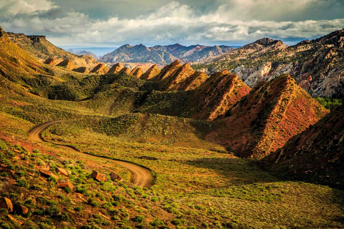
Scenic Byway 12, which winds through Southern Utah, opens up like the lyrics to a Bruce Springsteen song. Cross the county line onto a rattlesnake speedway, where the highway climbs and the sun makes your eyes go blind. Plunge into canyons beneath clouds rising from the desert floor. Then follow the road until its secret gardens, painted deserts and crimson grandeur blow away your dreams. In this homeland of the road trip—amid landscapes of movie-set America and mind-bending mesas—the sense is you can find some kind of promised land.
In America, the open road is a landscape that is both real to the traveler and illusory to the mind. It is never just geography—it is a metaphysical place of dream chasing—and, when the road opens up, the country’s backbone of flatlands, badlands and desert lands makes it a heavenly backdrop for leaning into Americana and US history. Here, highways are an escape from the everyday lulls and, on this sizzling hot morning, I’m driving Utah’s most famous road, a 123-mile bitumen-bound belt otherwise known as the ‘Journey Through Time Scenic Byway’, or just Highway 12.
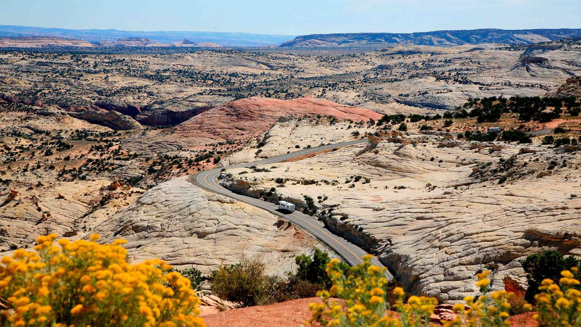
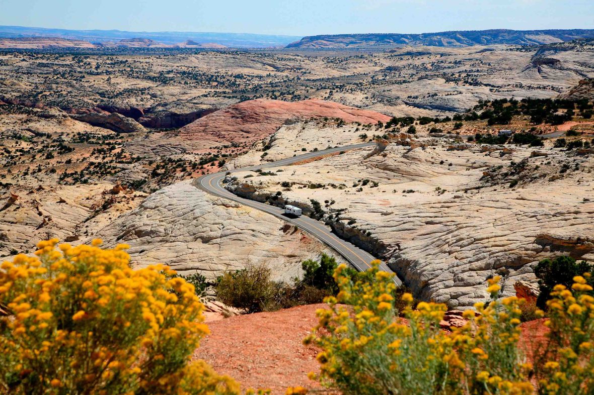
I’ve left the road’s eastern gateway town, Torrey, behind in the rearview and I’m now closing in on The Hogback—a knife’s-edge spine of slickrock in the Grand Staircase-Escalante National Monument, an enormous chasm of canyons and the last area to be mapped in the contiguous US. From a drone’s perspective, it’s a black scar on a landscape of shimmering white gold. From behind the steering wheel, it’s a strip of seemingly impossible vertiginous asphalt clinging atop terrain that spills into deep gulches and creeks—they uncoil like bullwhips on either side, then disappear. The road is more meandering than corkscrew, but it is slow, with up to 1,000ft drops on either side.
“We’re on the edge of nowhere here,” says Jamie Skidmore, park manager of nearby Anasazi State Park Museum, who greets me by the roadside. “There is still plenty of land around us that hasn’t yet been fully explored.”
Today, the Anasazi State Park Museum in the isolated, high-altitude town of Boulder is home to a 900-year-old village, where the Ancestral Puebloans of the American West survived among the desert sage. And still today, artifacts from their time and other prehistoric Native American cultures litter the unplumbed canyons. When you stop and look off the highway, you glimpse the ghosts of the lives that once drew breath here.
Road trips are like green traffic lights for travelers, but while many know the United States as an asphalted realm of bucket-list journeys, few will be aware of the country’s National Scenic Byways. Created in 1991 by US Congress and administered by the Federal Highway Administration, the National Scenic Byways Program now spans 48 states and the District of Columbia, totaling 184 American Byways, an umbrella term for both designated National Scenic Byways and All-American Roads.
Last year, in a bid to boost slow travel, 34 National Scenic Byways and 15 All-American Roads were newly added to the United States’ sacred road map. Designated by the US Secretary of Transportation, the additions make the country feel like it is stretching out again after the COVID-19 pandemic. But in reality, they are a way of spying opportunities in many of the beautiful, if unloved, spaces along America’s often forgotten roads. Because while America’s Scenic Byways offer access and connections to the great outdoors, they also unequivocally spur tourism spending and support businesses by the roadside.
“Tourism and recreation are predominately the driving force behind the nomination of roads as Scenic Byways,” explains Neil Gaffney, Office of Public Affairs spokesperson for the Federal Highway Administration. “But in order for a roadway to be designated as a National Scenic Byway, the proposed roadway must protect one of the route’s intrinsic qualities—historic, cultural, natural, archaeological, recreational or scenic.”
Already, thriving industry has built up around many of these roads. No visitor to the US needs an introduction to the motels, pitstops and roadside heritage of Historic Route 66 or California’s Pacific Coast Highway 1, for instance. And a sign of betting on good times ahead has brought extra funding. In March this year, the Federal Highway Administration announced an extra $16 million for the National Scenic Byways Program—the first Congressional appropriation in more than a decade.
“Scenic Byways can help local communities economically by attracting visitors,” adds Gaffney. “To help realize this goal, the Federal Highway Administration provides grants that communities can use to bolster their economy by building facilities such as rest areas and overlooks, making improvements that enhance access, and by protecting scenic, historical, recreational, cultural, natural, and archaeological resources in an area adjacent to a Scenic Byway.”
It’s enough to make an owner of a Buick, Caddy or Chevy weep with joy.
I’ve come to Utah in particular because the state’s first and only All-American Road has almost become a yardstick of the Scenic Byways’ economic success. With an Old West feel that falls somewhere between dust devil country and boho cowboy terrain, the 123-mile safari could be billed as the wildest—yet coolest—and most sophisticated drive in the American West.
From Torrey, the byway winds through Jurassic corners populated by rock arches and stone bridges sculpted by the winds and waters of eternity. Between the low desert scrub and petrified forests, it is the gateway to a surreal collision of geology that has shaped history and tested lives.
Under a sky of eternal blue, we are alone in the canyons, with only the skeletons of million-year-old crocodiles for company.
By the time it runs out of gravel, seven miles south of Panguitch, it’s meandered through three state parks, one national recreation area, one national monument, one national forest and two national parks, including the hoodoo-filled gorges of Bryce Canyon National Park. Spend even a few days exploring its slender-width gullies and narrow-grooved ravines, and you’ll start realizing that this is a landscape with more slots than nearby Las Vegas.
The tourism jackpot counts, too, of course. And the most recent Utah State Government figures —albeit from 2014—show that visitors driving Scenic Byway 12 every year bring in excess of $12 million.
Here in Utah, the byway’s scale and spectacle is bewildering, but its bond with such pristine wilderness means going slow is the real joy. One such roadside diversion is discovering the canyons that unfurl below the elevated desert meadows of Escalante, a town with a name as puzzling as its surrounding topography.
In 1776, two Franciscan priests, Atanasio Domíngueza and his apprentice, Silvestre Vélez de Escalante, attempted to find an overland route from New Mexico to a Roman Catholic mission in Monterey on the central Californian coast. Led by Domíngueza, the pair wandered the harsh Utah desert—led on by visions of God, perhaps—before returning to Santa Fe, having never reached California or present-day Escalante. For whatever reason, Domíngueza was written out of history, while Escalante’s legacy flourished. Today, a river, mountain range, desert, national monument and town are named after the junior priest.
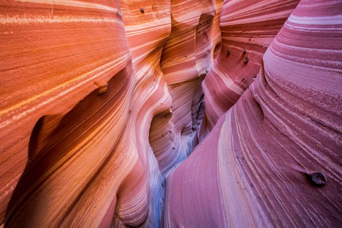
Early one morning, Rick Green, guide and co-owner of Excursions of Escalante, drags me from the roadside out into the depths of Grand Staircase-Escalante National Monument along Hole-in-the-Rock Road, on a hair-pricking canyoneering adventure. In the midst of this rugged swathe, there are hundreds of remnant bones and trails of three-toed dinosaur prints—Allosaur theropods and a Tyrannosaur named Lythronax, meaning ‘King of Gore.’ Beneath the roadside plateau, where oyster and clam shell fossils from the Cretaceous litter the landscape, the terrain becomes richly hued, turning golden orange, sunburst and bright marigold. Further down, where the sandstone has eroded, hundreds of slot canyons have formed, many of which have never been explored.
This is where the likes of Green and the world’s best canyoneers belay, anchor, bridge and rappel tight channels of boulders and pour-offs. In the extreme heat, the land almost shivers up to the sky, but it is misleading. This is an area that sees a dozen or so fatalities every year because of sudden flash floods.
“If North Hawaii is the world’s best surf destination, then Escalante is what gets canyoneers out of bed in the morning,” says Green. “We are on the Colorado Plateau, which has been uplifted, eroded and fractured for millions of years. But the canyons here are astonishing. We have the most in America, the most beautiful, and the most concentrated.”
Under a sky of eternal blue, we are alone in the canyons, with only the skeletons of million-year-old crocodiles for company. Here, juniper and pinyon pine cut their limbs off to survive extreme drought. A restless paleontologist might consider this the perfect holiday.
Southern Utah has always been an outlier of sorts. Many of the desert towns along Scenic Byway 12 were first settled by Mormon pioneers. Wagon trails and mule trains connected many of its hard-to-reach settlements much later than in other states. The first all-weather link between the towns of Boulder and Escalante was only completed in June 1940—more than a century after the first road in the country was tarred in and decades after the completion of the Lincoln Highway, America’s first coast-to-coast freeway, in 1912.
With almost two-thirds of the state owned by the Federal Government, Utah has tended to lean on geology, geography and time to find a way around—or through. The Henry Mountains, east of Scenic Byway 12 and Capitol Reef National Park, for instance, was the last range to be added to the map of the 48 contiguous US states in 1872.
Thanks to geology, a journey along Scenic Byway 12 presents a timeline of sorts of Earth’s evolution. In such a thirsty land, it’s perhaps ironic that water has had a God-like effect on the roadside landscape.
But only recently have new arrivals begun breathing life along the roadside. I find taco splendor at Magnolia’s Street Food in Boulder and an unlikely vegan menu at Kiva Koffeehouse, a refuge amid the crescendoing waves of pink and salmon cliffs overlooking Calf Creek.
This trend for regeneration—more than that, regenerative travel—isn’t uncommon out of state either. Even though Scenic Byways were designated by the Federal Government after the creation of the larger, faster Interstates that serve as more efficient ways to get across the country, tourism is continuing to transform many of the local economies of the towns the American Byways pass through.
Virginia’s Skyline Drive, running through Shenandoah National Park in the Blue Ridge Mountains, for instance, saw a spike of 1.6 million visitors last year, up 12 percent from 2019. Likewise, the Blue Ridge Parkway, known for its blazing flower and foliage displays, has seen increased traffic, up 13 percent between 2020 and 2021. And according to a 2019 National Parks Service report, the Scenic Byway’s estimated 14.7 million visitors spent $1.1 billion while exploring local gateway regions, supporting nearly 16,000 jobs.
“The pandemic forced many of us to slow down and experience a deeper appreciation for life,” says Virginia Tourism’s Rita McClenny. “Driving a Scenic Byway and being in the great outdoors, not only speaks to that increased appreciation of all living things, it also was one of the few ways we could still travel, tucked safely inside a vehicle with only close family. Once you’ve learned to appreciate things, it’s much harder to give them up—so we see increased travel on Scenic Byways as something that’s here to stay.”
Another corner of America welcoming the byway boom is the Northern Rockies states. Here, the scenery takes center stage. The 68-mile Beartooth Highway from Montana to Wyoming now brings wide-eyed road trippers into Yellowstone National Park. South Dakota’s Badlands National Park, which shelters Badlands Loop State Scenic Byway, has also seen mounting growth over the past decade. And it is a trend that shows no signs of dropping off elsewhere.
“In Idaho, the Scenic Byways are the best way to get travelers into the heart of the state to see our beautiful landscapes and to reach the outdoor activities many come to experience,” says Katie Pegan of Idaho Tourism. “We’ve seen an increase of travelers across the state, with last year, July 2021 to June 2022, being the busiest year on record for collecting state bed taxes.”
Nearly two centuries after Scottish shipbuilder Ebeneezer Bryce moved to Southern Utah, I turned into Bryce Canyon National Park on the last stretch of my Scenic Byway 12 journey. Bryce had the park named after him in 1928 and it is not hard to see why he once said it was “a hell of a place to lose a cow.” The maze of frost-weathered hoodoos that the Mormon pioneer knew still grips the cool heights of the national park, but only because time hasn’t yet caught up with the natural amphitheater—the canyon remains the fastest eroding protected area in America.
Its spires, rock chimneys and monoliths soar like a land of disjointed fingers and thumbs.
Thanks to geology, a journey along Scenic Byway 12 presents a timeline of sorts of Earth’s evolution. In such a thirsty land, it’s perhaps ironic that water has had a God-like effect on the roadside landscape and its role as creator has seen water carve the mesas and buttes, chiseling form and features into every rock face. The signature feel of this is the sun-scorched byway carries us away from civilization—away from the heavy tread of modern life—to places where the light tilts, perspective changes and we can see our world anew. All that’s missing, for me at least, is the reset button.
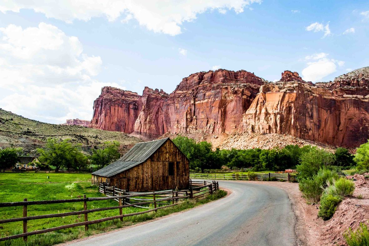
On my final day, I watch as the milometer counts down the final few snaking twists through the Mars-like formations of Red Canyon. Then, all that remains is to meet the end of the Scenic Byway, at mile 123, at the intersection with Highway 89.
As clear as the road ahead is, it could never show the future of the National Scenic Byways of America and it only hints at where the story might lead. Definitely, the byways’ purpose is to make travelers appreciate unfamiliar and unknown corners of the US, but it is also to settle us into the slow rhythm of unhurried roads and have us craving more.
In my mind, the success of Utah’s All-American Road goes beyond the murmur of the engine. The rush of the open road. The euphoria at escaping the Interstate. The lyrics of a Bruce Springsteen song. It is in the drive to help us bond with a landscape and its people in new ways. Only then, at journey’s end, can we realize the promise of its evangelized American dream.



Can't find what you're looking for? Try using these tags: