In the Australian state of New South Wales, Sarah Reid hits a long-awaited new trail that connects her to the world’s oldest and largest subtropical rainforest—in more ways than one.


In the Australian state of New South Wales, Sarah Reid hits a long-awaited new trail that connects her to the world’s oldest and largest subtropical rainforest—in more ways than one.
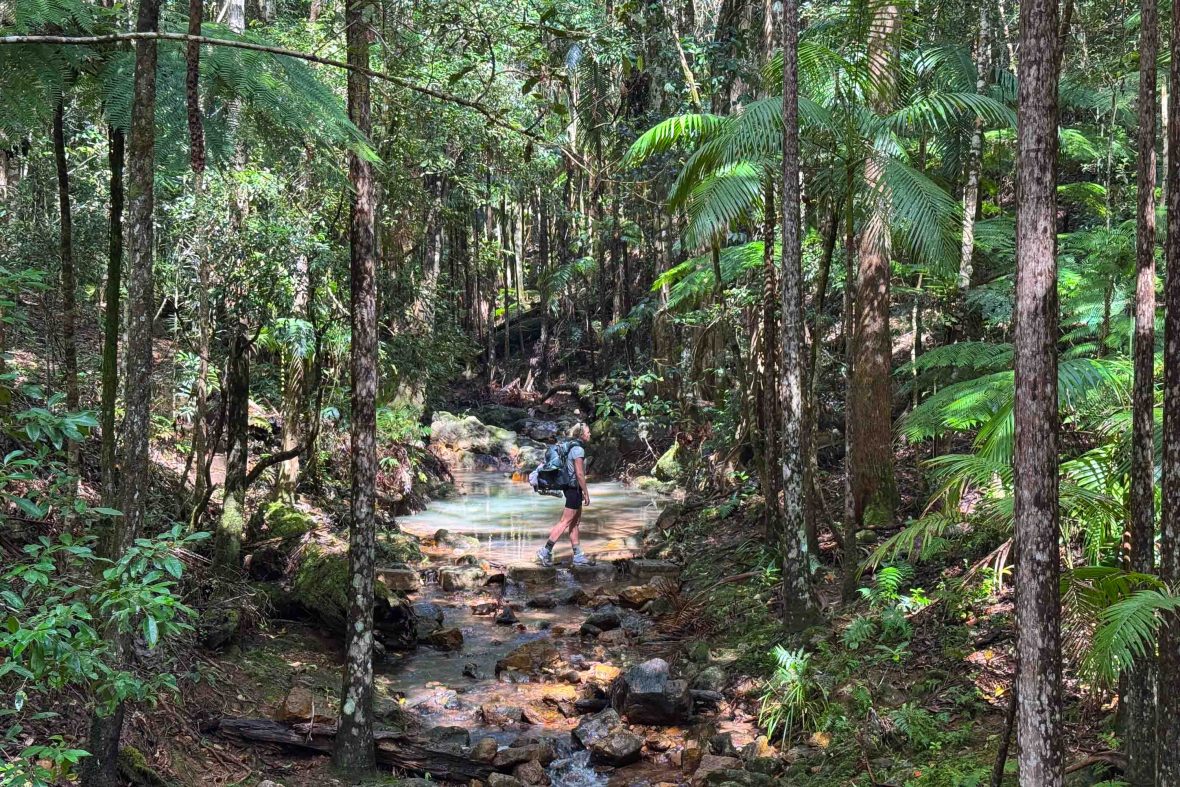
Dumping my 31lb (14-kilogram) pack and reaching down to unlace my muddy boots, my hiker’s high evaporates when I discover that the baby-blue lining of my left boot has turned scarlet red. Blood oozes from several bite marks on my ankle, but the culprits have absconded. There’s another bloodbath in my right boot. I begrudgingly accept defeat—the vampires of the rainforest win this round.
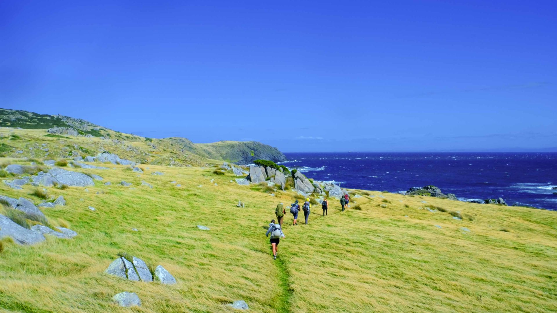
As a local of northeastern New South Wales (NSW)—among the wettest areas of the state—I anticipated a leech-fest on the Gidjuum Gulganyi Walk, a newly opened four-day, 26-mile (42-kilometer) hiking trail tracing the volcanic ridges and valleys of the lush Tweed-Byron hinterland. But I make a crucial error.
After taking a refreshing dip in a terraced waterfall near the end of the first leg of the trail, I fail to reapply insect repellent for the final push to Sand Ridge Campground. Fortunately, Aussie leech bites aren’t usually harmful—just messy and incredibly itchy.
The first multi-day walk for the region, the Gidjuum Gulganyi Walk consists of new and existing trails that connect three protected wilderness areas including Nightcap National Park, part of the World Heritage-listed Gondwana Rainforests of Australia stretching across the NSW North Coast and southeast Queensland.
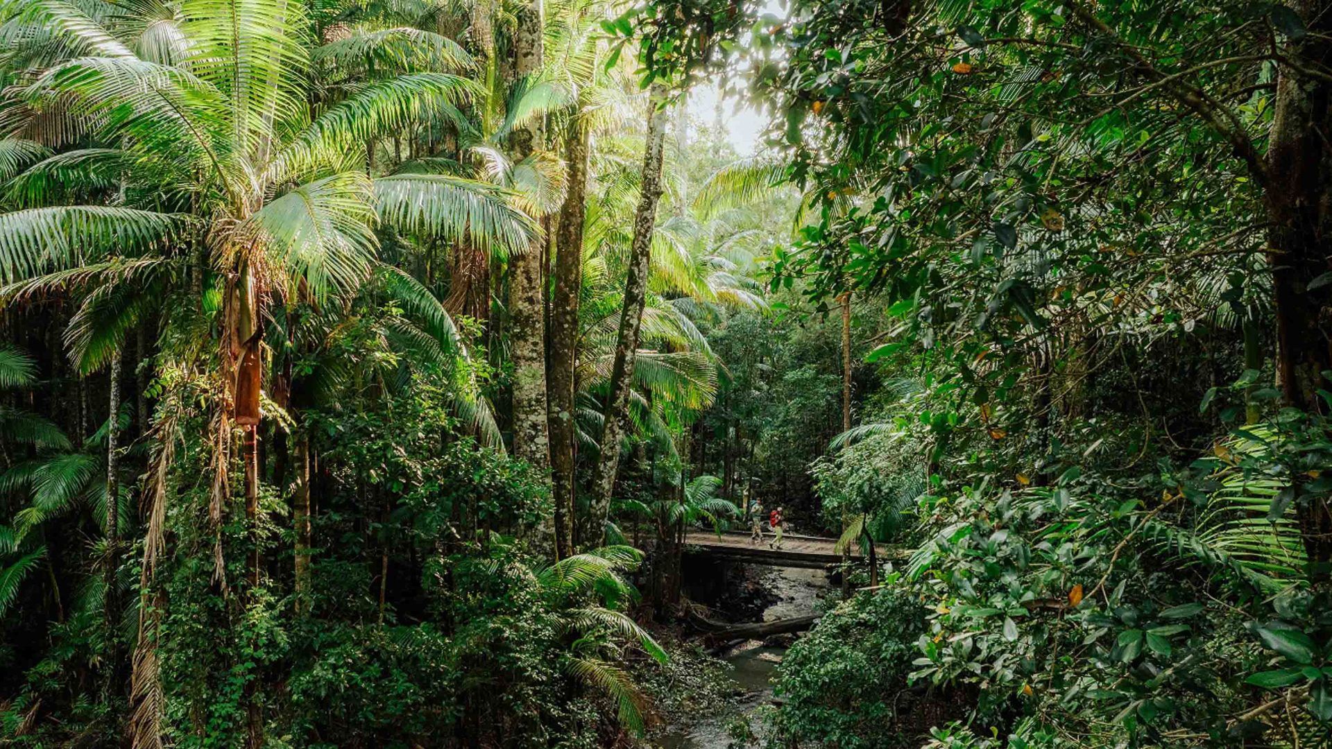
Home to the world’s oldest and most extensive areas of subtropical rainforest, this otherworldly oasis of biodiversity—180 million years in the making—provides a refuge for dozens of plant and animal species largely unchanged from the fossil record.
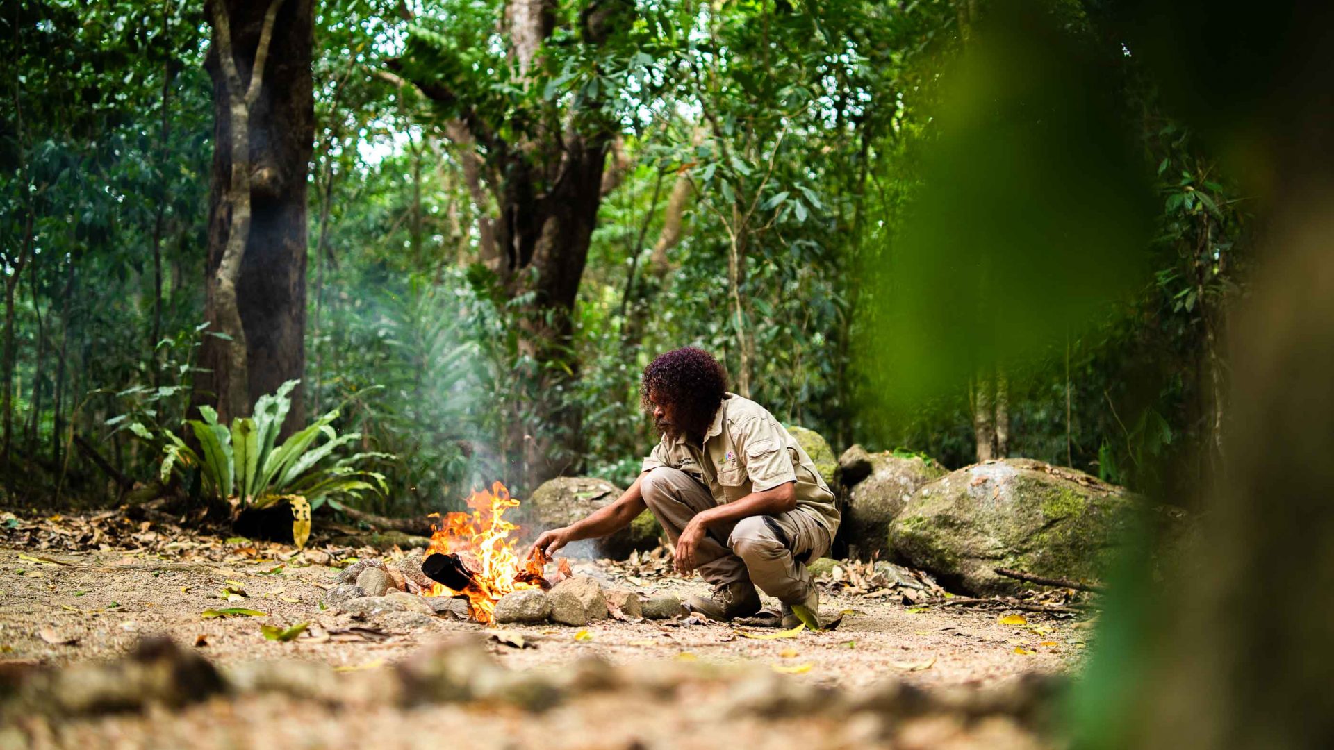
“It is part of a traditional pathway that our ancestors used to walk many, many years ago to get from Widjabul Wai-bul Country across to Minjungbal Country in the north.”
- Ashley Moran, Widjabul Wia-bal Gurrumbil Aboriginal Corporation
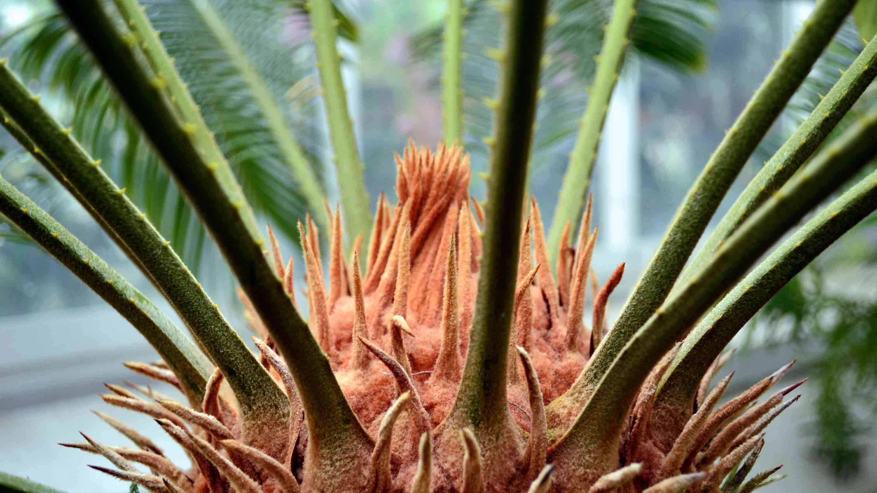
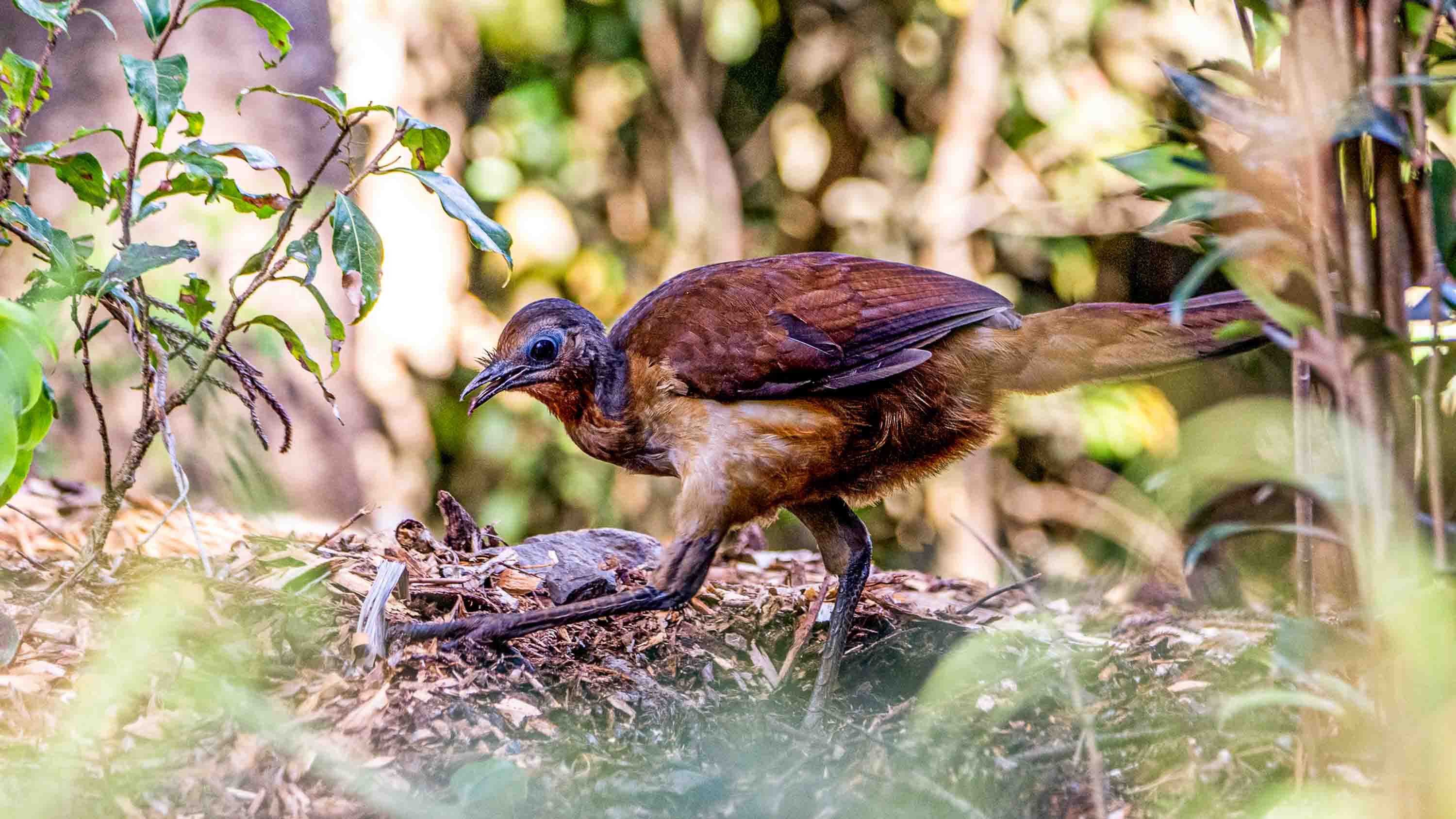
While not officially part of the UNESCO site, Mount Jerusalem National Park (where the trail begins) and the Whian Whian State Conservation Area are equally spectacular, with all three wilderness areas embossed with waterfalls, studded with ferns and palm-like cycads (which outlasted the dinosaurs) and home to elusive wildlife including the vulnerable Albert’s lyrebird, described by Sir David Attenborough as having “the most beautiful song in the world.”
“It’s such a great opportunity to experience the area’s natural beauty,” says Wendy Bithell, owner of Vision Walks Eco Tours, one of two local operators offering guided hikes on the new trail. Vision Walks also operates return transfers from regional hubs to the remote trailhead, under an hour’s drive from the tourist magnet of Byron Bay, for self-guided hikers like my husband Tim and I who opt to carry our own gear and food. With three nights of camping costing AUD$173 per campsite (USD$112), a long weekend away in the Byron region doesn’t get much cheaper than this.

Having both grown up on the doorstep of this age-old rainforest—which inspired the 1992 animated film, FernGully, starring Robin Williams as a discombobulated bat—Tim and I are both eager to immerse in it more deeply on the new walk, developed over more than half a decade.
Hitting the trail is particularly significant for Tim, whose grandfather, a former NSW Labor Party MP, was involved with the local Terania Creek anti-logging protest in 1979—Australia’s first major environmental protest—as well as the NSW Government’s 1982 ‘Rainforest Decision’ that led to the creation of Nightcap National Park and other parks protecting the state’s last stands of Gondwana rainforest.
‘Gidjuum Gulganyi’ means ‘Old People’s Track’ in the language of the area’s Traditional Custodians, the Widjabul Wai-bal and Minjungbal people of the Bundjalung Nation. “It is part of a traditional pathway that our ancestors used to walk many, many years ago to get from Widjabul Wia-bal Country across to Minjungbal Country in the north,” says Ashley Moran, chair of the Widjabul Wia-bal Gurrumbil Aboriginal Corporation.
Picking off yet another leech marching up my boot, I’m in awe of how Ashley’s ancestors traversed this teeming rainforest without shoes—or DEET. I imagine they avoided traveling during the region’s wettest (read: leech-iest) months (roughly January to April) when Tim and I hit the trail.
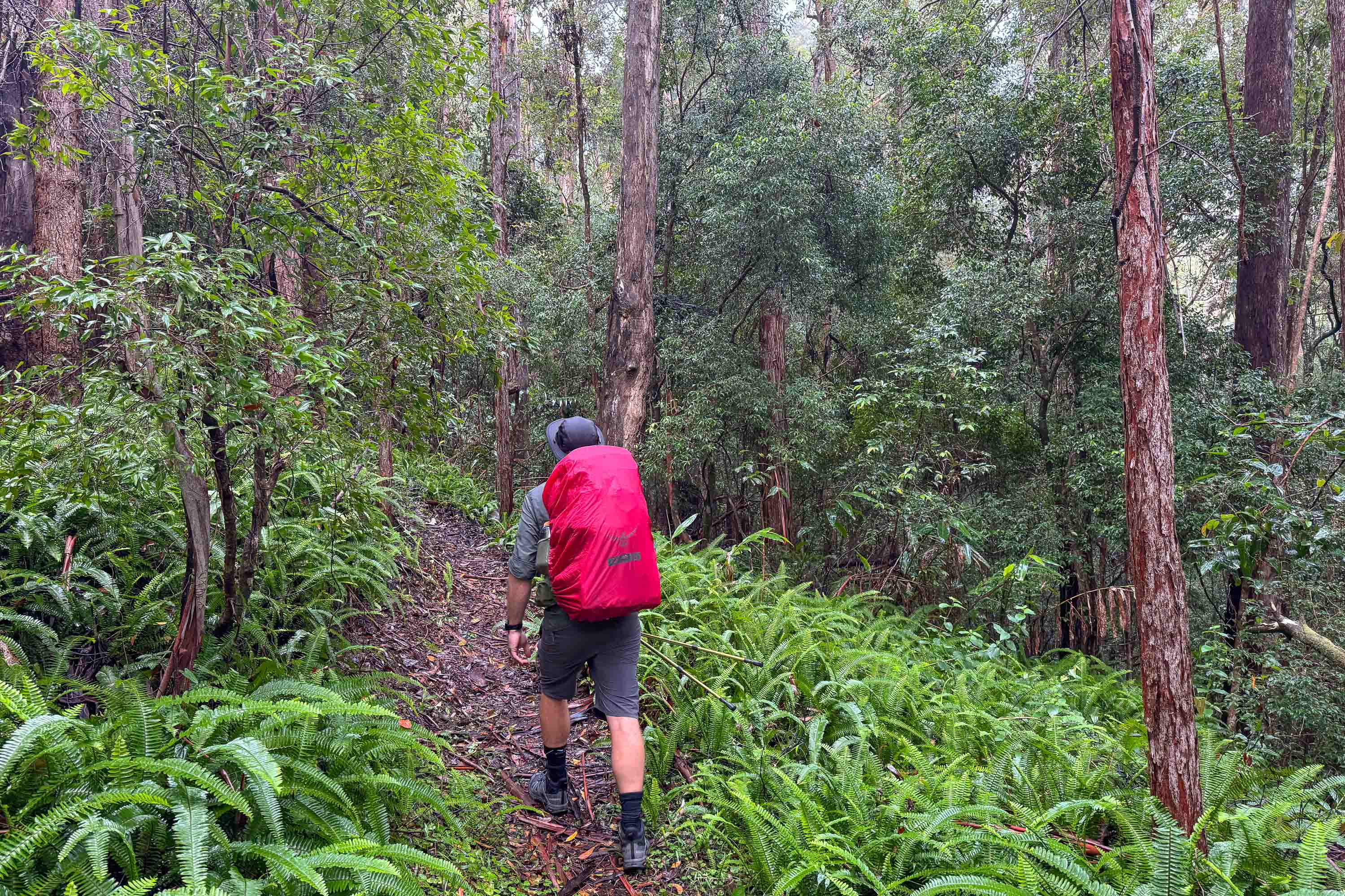
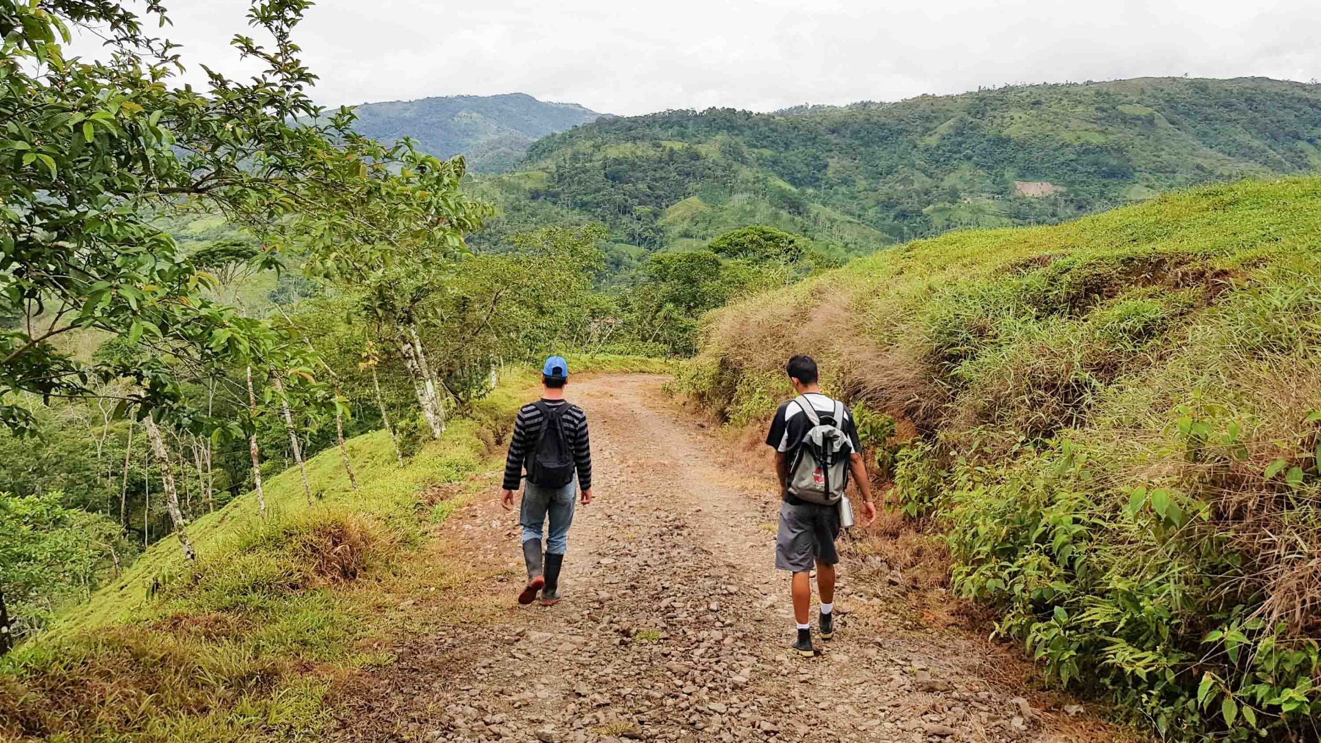
The NSW National Parks and Wildlife Service (NPWS) describes the Grade 4 Gidjuum Gulganyi Walk as suitable for fit and experienced bushwalkers with strong navigation skills—and this is particularly applicable to day two. The trail is difficult to follow at times, making our GPS invaluable. With our Garmin clocking a total distance 11.4 miles (18.4 kilometers) and an ascent of 3396 feet (1,035 meters), it’s the longest and most challenging section by far.
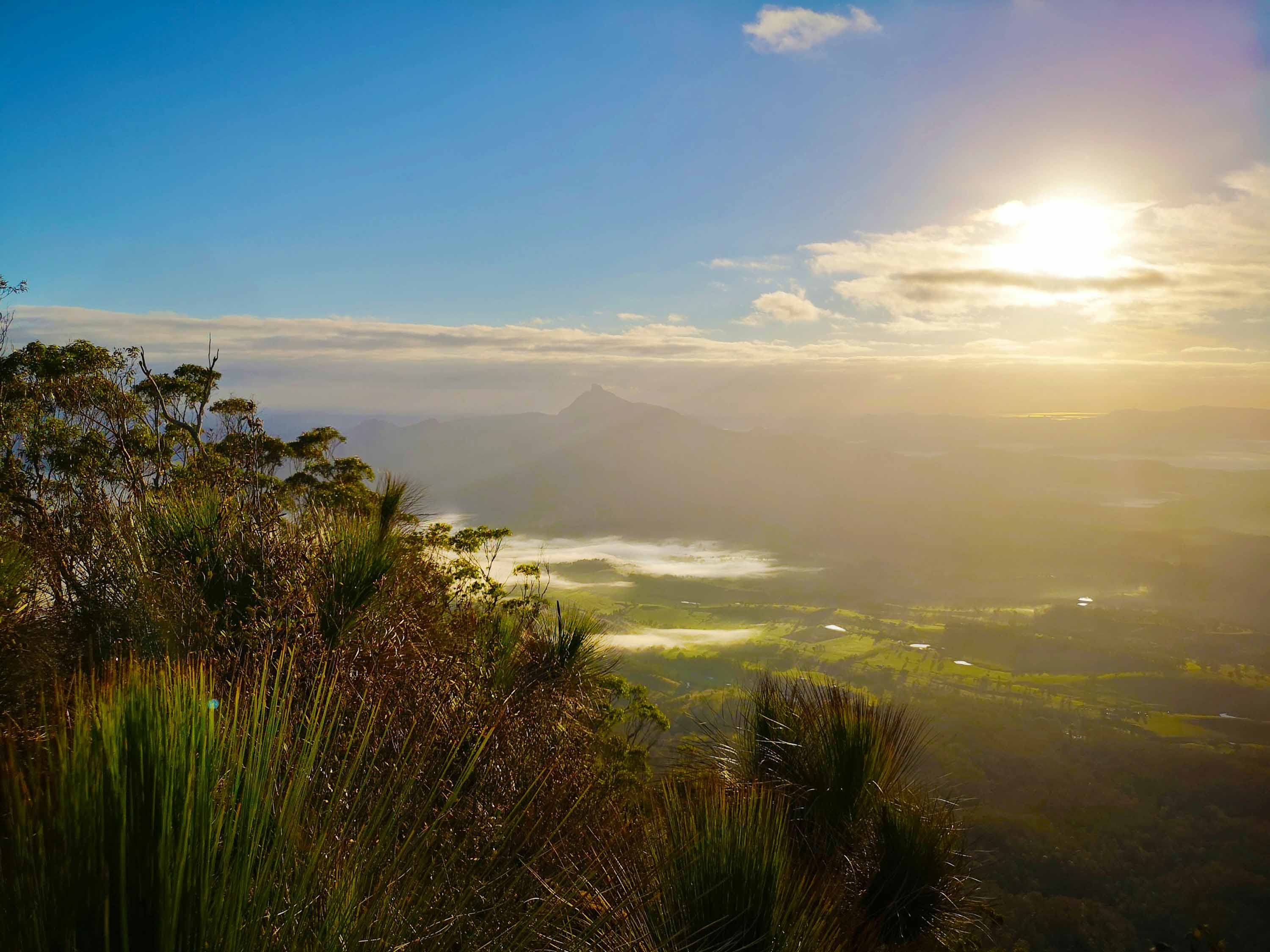
Yet the day-two slog rewards us with multiple views of another important local Aboriginal site: Wollumbin, formerly Mount Warning. Once one of Australia’s most popular day walks, the trail to the crooked summit (3796 feet/1157 meters) of this mountain forming the central vent of an ancient shield volcano was closed in 2020 for safety and cultural reasons. Having hiked to the Wollumbin summit myself as a child, long before signage advised walkers that it went against the wishes of Bundjalung Elders, I can confirm that the Gidjuum Gulganyi Walk offers a more rewarding, as well as respectful, alternative.
With its sweeping views across Wanganui Gorge to Goonengerry Falls from its cliffside yarning circle, the third-night Weeun Weeun Campground is a place I could happily spend a lazy afternoon swapping leech stories—if it wasn’t pouring with rain.
The new trail is also embedded with colonial history; in some sections, it follows old logging routes forged by timber getters in the 1830s. It also shares part of the Historic Nightcap Walking Track, a route traversed by travelers and postal workers making their way across the Nightcap Range between Lismore and Murwillumbah up until the early 1900s.
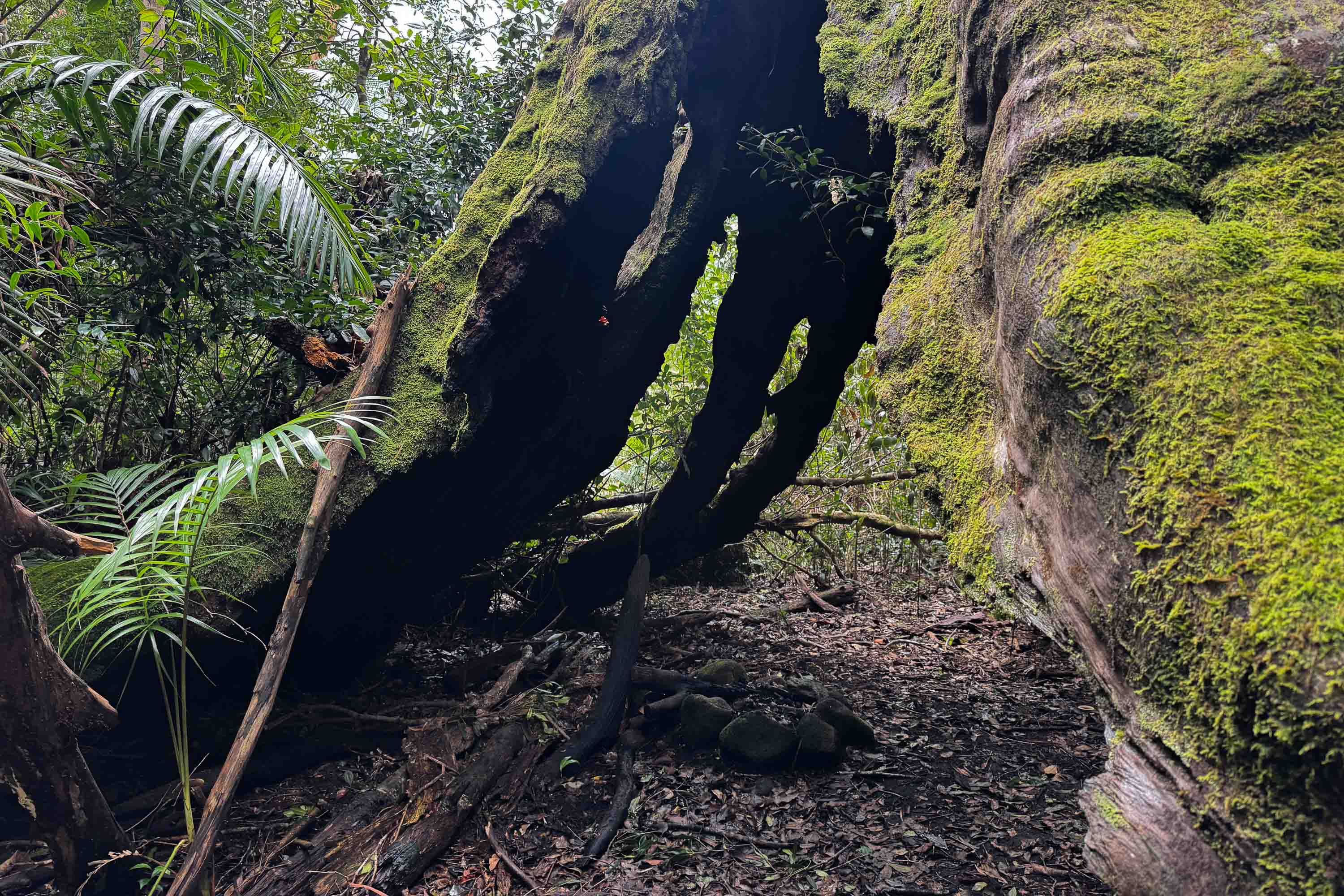
Towards the end of day two, we pause at the huge, burned-out tallowwood tree they used as a natural shelter tucked just off the left-hand side of the path. Known as the Postman’s Tree, it’s a rare physical legacy of the era.
The wet conditions also dictate our wildlife sightings. Our first night, these include a tiny pouched frog and a giant panda snail, its glistening trail reflected by my headtorch on a late-night loo run.
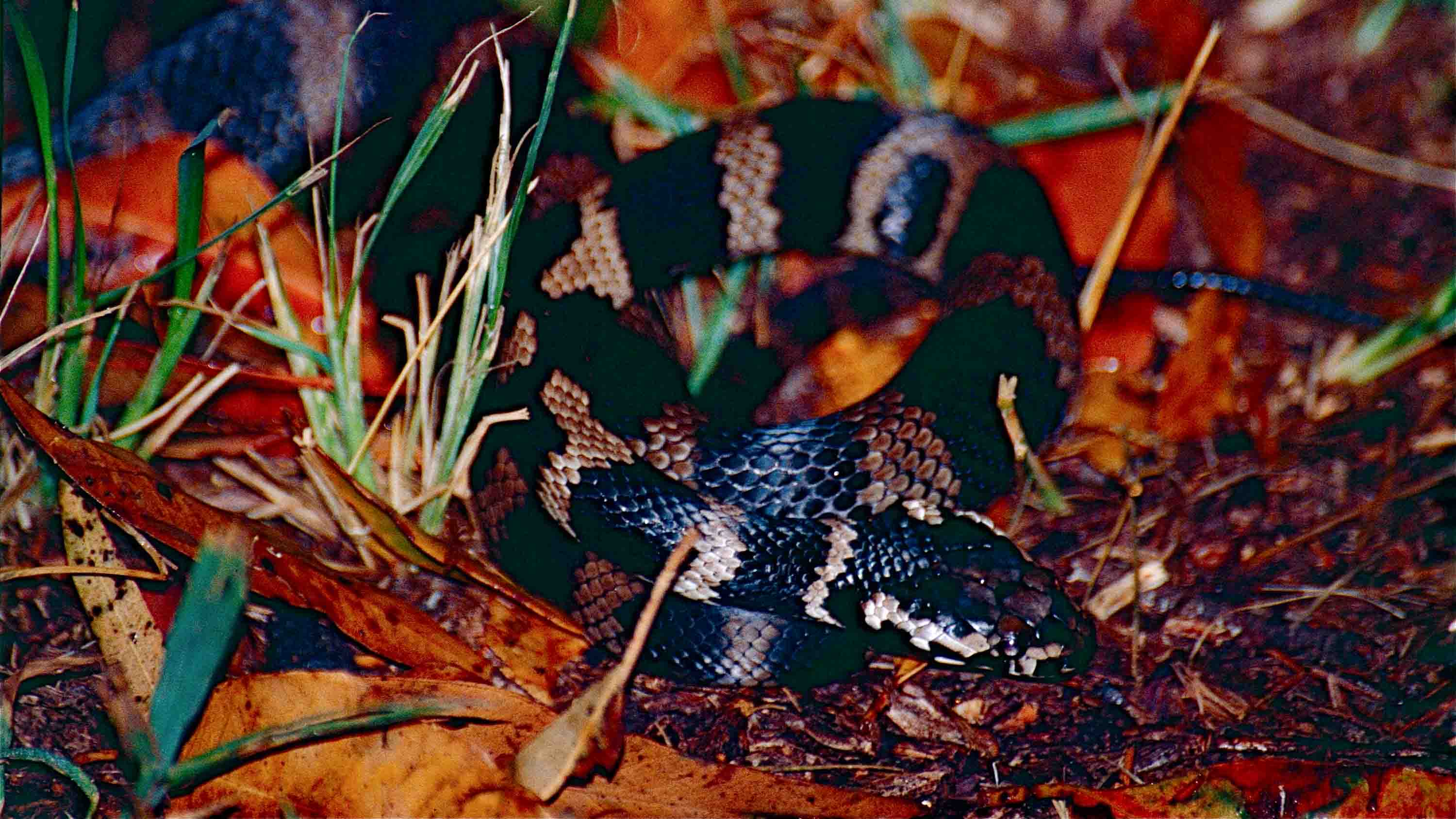
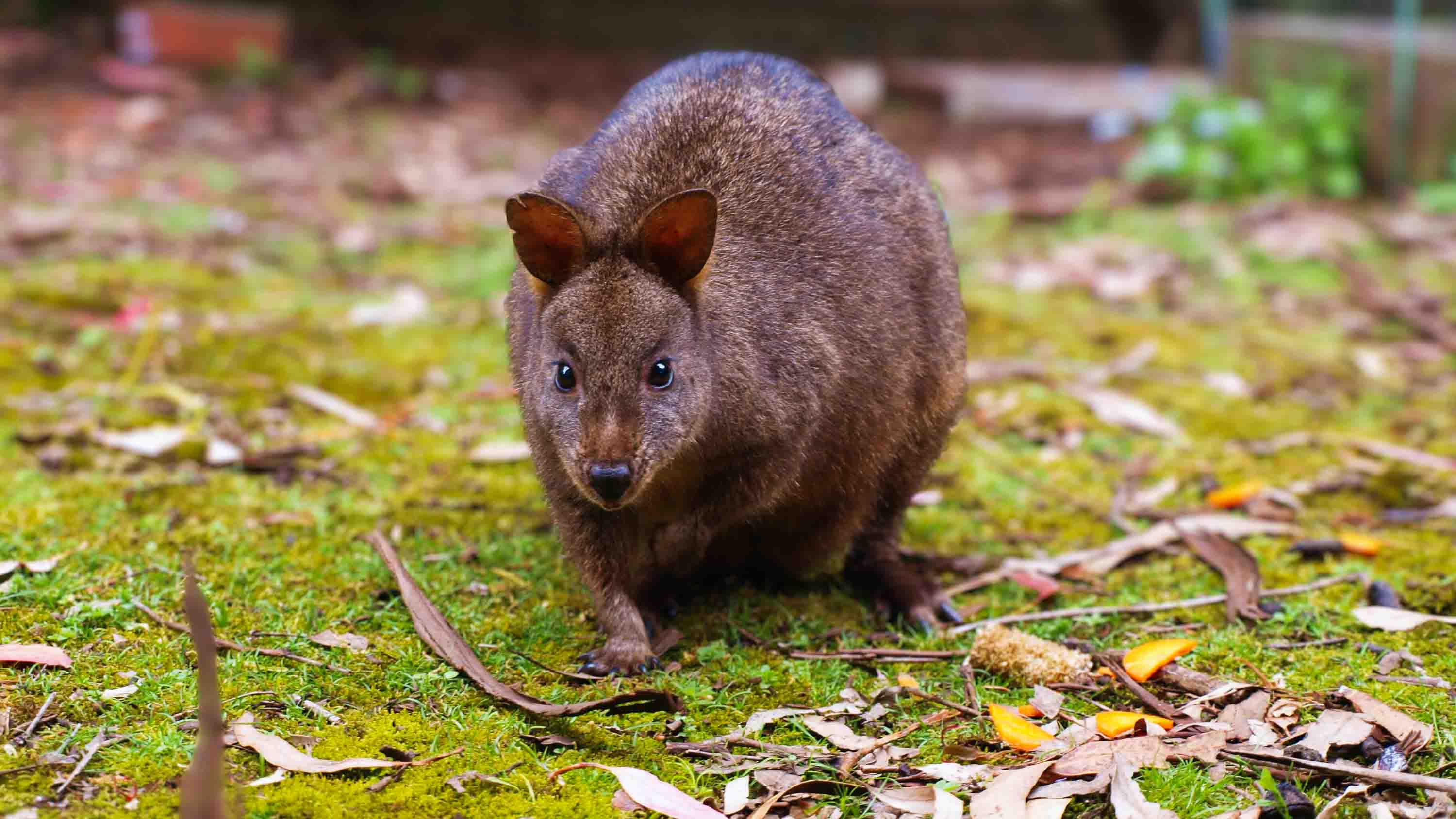
Our climb up the steep sandstone steps helicoptered in to create the second leg of the trail is backed by the distinctive whip-crack of the eastern whipbird, one of the most iconic sounds of the Australian rainforest. A Stephens’ banded snake slithers across our path on day three, and we encounter several pademelons—small marsupials which resemble miniature kangaroos—throughout our journey.
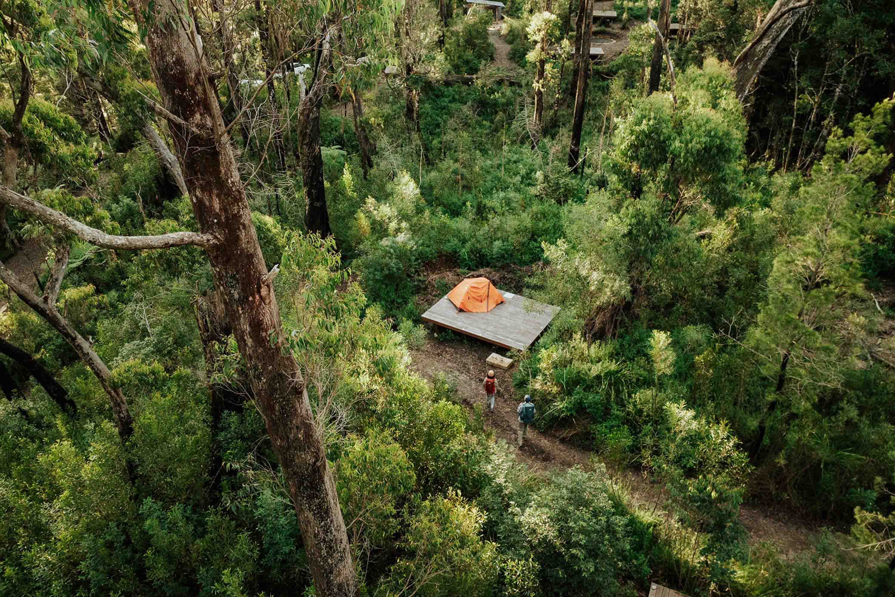
Shaded by towering eucalypts and freckled with lime-green Bangalow palms, Sand Ridge Campground is the wildest of the three new walk-in campgrounds, narrowly making it my favorite, but all three are scenic. Each has two sections, with six timber tent platforms (each with room for two) for private groups and five platforms for self-guided walkers.
Each area shares a long, single covered table for communal camp-cooking and an open-air ‘yarning circle’ (a circular seating area fashioned from fallen logs; ‘yarn’ is Australian for ‘have a chat’), encouraging a maximum of 22 campers between the two sections to mingle. Though a quick exit from all campsites is possible via park maintenance trails in case of a bushfire or another emergency, misty Sand Ridge feels lightyears away from civilization.
With its sweeping views across Wanganui Gorge to Goonengerry Falls from its cliffside yarning circle, the third-night Weeun Weeun Campground is a place I could happily spend a lazy afternoon swapping leech stories—if it wasn’t pouring with rain.
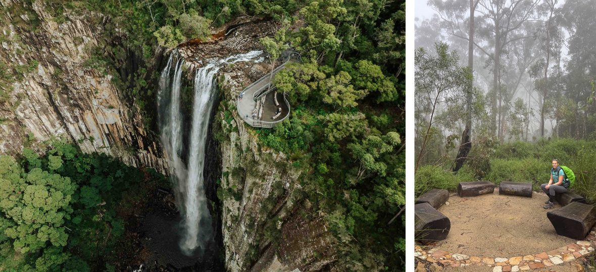
Tim and I instead press on to the end of the trail at the top of Minyon Falls, extending the third leg of our walk to a total of 12.2 miles (19.6 kilometers) by our calculations. Compressing the experience like this makes it tricky to extend further to include the epic eight-mile (13-kimometer) return hike to the base of the 328-feet-high (100-meter) Minyon Falls—which I highly recommend if you have the time and stamina.
As you cool off in the natural pool at the base of the falls, where sheer rhyolite cliffs shoot up above the rainforest canopy, it’s easy to appreciate both the ecological and spiritual significance of this ancient ecosystem. Having hiked this extension many times before, we head home a day early instead to a warm, dry bed—and a significantly reduced risk of another leech attack.
**
The writer hit the trail with support from NPWS/New South Wales National Parks and Wildlife Service. Visit the official website for essential safety information.
****
Adventure.com strives to be a low-emissions travel publication. We are powered by, but editorially independent of, Intrepid Travel, the world’s largest travel B Corp, who help ensure Adventure.com maintains high standards of sustainability in our work and activities. You can visit our sustainability page or read our Contributor Impact Guidelines for more information.

Sarah Reid is an award-winning travel writer, editor and author with a passion for positive-impact adventures and exploring underrated destinations. Her book credits include The Sustainable Travel Handbook, published by Lonely Planet.